In the autumn of 1929, Anne Morrow Lindbergh and her husband Charles flew across the Yucatán Peninsula. With Charles at the controls, Anne snapped photographs of the jungles just below. She wrote in her journal of Maya structures obscured by large humps of vegetation. A bright stone wall peeked through the leaves, “unspeakably alone and majestic and desolate — the mark of a great civilization gone.“
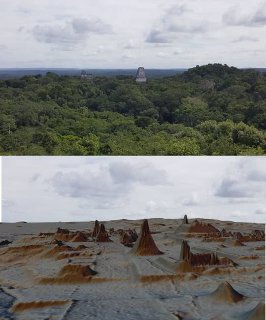
Nearly a century later, surveyors once again took flight over the ancient Maya empire, and mapped the Guatemala forests with lasers. The 2016 survey, whose first results were published this week in the journal Science, comprises a dozen plots covering 830 square miles, an area larger than the island of Maui. It is the largest such survey of the Maya region, ever.
The study authors describe the results as a revelation. “It’s like putting glasses on when your eyesight is blurry,” said study author Mary Jane Acuña, director of El Tintal Archaeological Project in Guatemala. Read more.
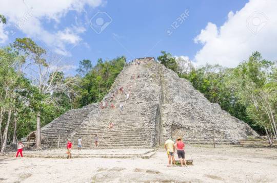
Years ago I hauled myself by rope up the steep stairs to the top of the enormous pyramid at Coba. (stock photo below) The guide who was with me gestured panoramically, pointing out literally scores of suspiciously symmetrical hills stretching to the flat jungle horizon in every direction.
“Pyramids,” he said. “Every one of them is a pyramid. Almost none have been excavated.”
“Let’s go to one of them.”
He gave me the side eye. “That would cost you.”
“Name a price.”
He quoted me a price that was at the upper end of reasonable. In American dollars. I counted out the cash.
He smiled. “Oh, I should probably mention. They’re all haunted.”